DALLAS — Halperin Park represents the city’s promise to the community to transform the space above I-35E into open space for Southern Dallas and Oak Cliff residents. Designed with input from the community, the park includes expansive lawns, a performance space, shaded gathering areas, play areas, water features, and views of downtown Dallas. However, to get there, many visitors arriving on foot still have to cross a busy road.
This new deck park spans Interstate 35E near the Dallas Zoo. It aims to reconnect historic Oak Cliff, a community divided by highway construction in the 1950s. The park opened to the public in May 2026 after years of planning, fundraising, and public-private partnership.
Lou Ann Sims, a Tenth Street resident, said the park “brings people together.” Another resident, Kenneth Thomas, said he was glad he had lived long enough to see the east and west sides of the neighborhood reconnected.
The problem is not inside the park. It is just outside it.
At the park’s northern end, near South Ewing Avenue, there are painted crosswalks and traffic signals. But many visitors cross farther south, near the park entrance at Lancaster Road, where there is no crosswalk or traffic light. That is where the danger is: when the light at Ewing turns green, vehicles coming off I-35E speed past the park, putting pedestrians at risk.
The city is working with the Dallas Zoo and the Southern Gateway Public Green Foundation on longer-term pedestrian-safety and access improvements near South Lancaster Road and 12th Street. The Dallas City Council also approved up to $8 million to help complete the first phase of the plaza at Halperin Park.
However, as of this writing, the problem remains unresolved. Local residents hope the city will address the pedestrian-safety issue at Halperin Park. The concern is especially clear when Halperin is compared with Klyde Warren Park, Dallas’ first deck park. Klyde Warren sits in the middle of downtown, where pedestrians move through a more established street grid with traffic lights and marked crossings. Halperin Park, by contrast, spans I-35E and sits beside a busy freeway service road, making access more difficult for people arriving on foot.
A park meant to bring people together has to begin before the gate. Dallas does not need to wait for a tragedy to treat Halperin’s access problem as urgent.
Dallas is growing. From new residential neighborhoods to sprawling commercial complexes and expanding transportation networks, construction projects are reshaping the skyline and the suburbs alike. With this rapid pace of development, project managers, city planners, and developers are under increasing pressure to deliver efficient, cost-effective, and sustainable outcomes. To meet this demand, many in the industry are turning to a modern solution that’s already transforming sectors like agriculture and logistics: satellite imagery.
The use of satellite data in urban planning is not just about getting a bird’s eye view. The most recent satellite maps for visualisation and analysis allow professionals to zoom into the finer details, observing land shifts, tracking seasonal vegetation changes, and detecting early signs of environmental stress. This level of real-time awareness supports better decision-making at every step of a construction project, from early feasibility studies to long-term asset maintenance.
Satellite Data in the Construction Industry
The use of satellite imagery in construction is no longer a futuristic concept. Today, it’s a practical tool that offers detailed, real-time insights into the land, infrastructure, and environmental factors that influence how projects unfold. High-resolution images from satellites orbiting Earth provide an expansive view of terrain, land use changes, water bodies, vegetation, and even soil conditions. This technology allows teams to visualize conditions over time, monitor progress, and spot potential issues early, without needing to set foot on the ground.
Across the construction lifecycle, satellite imagery fills critical information gaps. It provides near-instantaneous updates on weather-related disruptions, offers validation for materials planning, and serves as a powerful tool in regulatory compliance. As cities like Dallas continue to expand into environmentally complex zones, the role of this data becomes even more important.
Why Use Satellite Imagery in Construction in Dallas
Dallas’s construction environment is as dynamic as it is diverse. From revitalizing historic neighborhoods in Oak Cliff to expanding industrial parks near the outskirts, developers must navigate a range of zoning, environmental, and logistical considerations. Here is where the latest satellite imagery becomes a powerful asset.
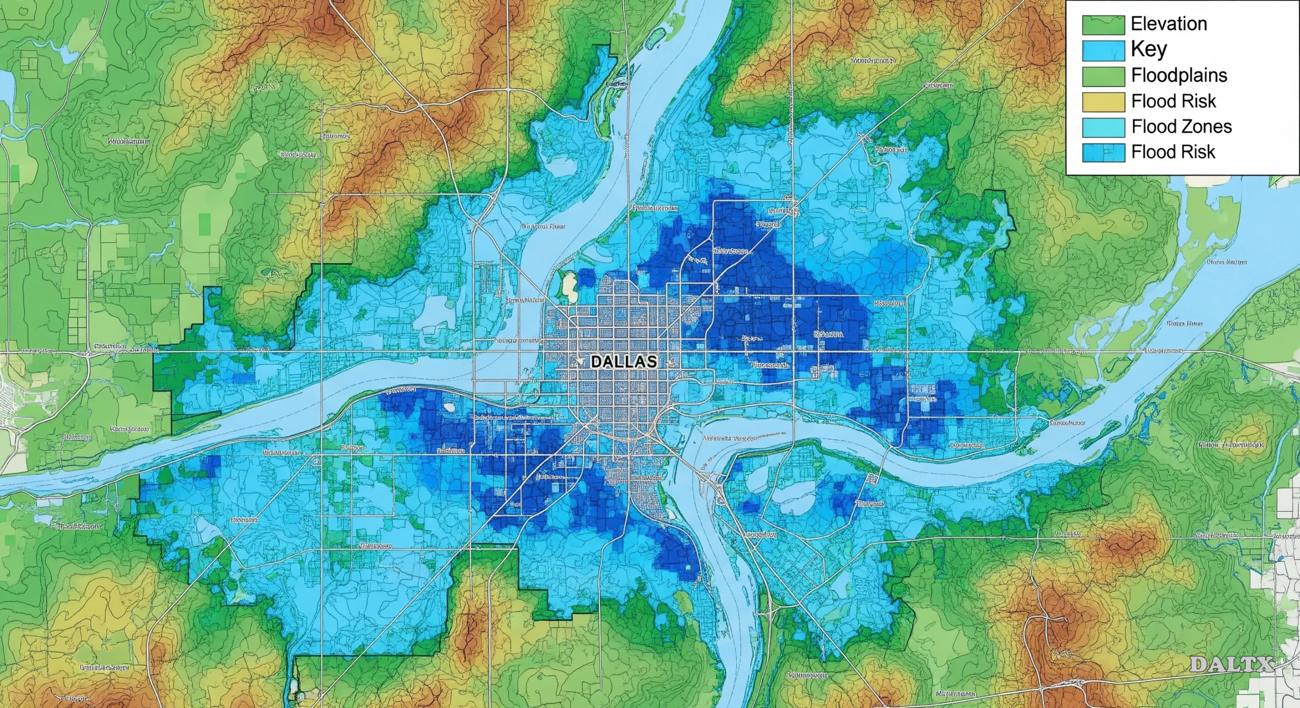
The city’s variable topography and fast-changing land use patterns make traditional survey methods expensive and sometimes outdated by the time data is processed. Satellite imagery provides a faster and more flexible alternative. For instance, high-resolution images can help detect subtle elevation changes, flood-prone zones, or land movement, which are all essential in planning foundation work and drainage systems.
For example, in California, NASA and the Jet Propulsion Laboratory use satellite‑based InSAR to track land subsidence in cities like Los Angeles and the San Joaquin Valley. These systems can detect ground settlement as small as a few millimeters well before visible damage occurs, alerting engineers to areas at risk of infrastructure failure or increased flood vulnerability. Adopting similar satellite‑guided monitoring in Dallas could help local construction and planning teams detect uneven soil movement, assess drainage system needs, and anticipate foundation stress across development zones, especially in flood‑prone or rapidly urbanizing areas.
Moreover, Dallas is no stranger to extreme weather events. Access to updated satellite images allows teams to assess storm damage, monitor soil saturation levels, or identify regions where runoff could pose a problem for construction timelines. These images also offer visual proof for insurance claims, environmental compliance, and internal audits.
One emerging trend is using imagery to analyze pre-construction site conditions during different times of the year. In a city with hot summers, unpredictable rainfall, and rapid vegetation growth, the ability to assess long-term patterns through recent satellite images of earth adds significant predictive value. It enables developers to plan around seasonal challenges instead of reacting to them.
How Satellite Data Can Benefit Everyone in the Dallas Construction Industry
The advantages of satellite data stretch across the entire construction pipeline, especially in a rapidly evolving urban hub like Dallas.
Project managers and developers benefit from being able to scope out land parcels more accurately. Before purchasing a site, they can use recent satellite images of Earth to evaluate how the land has been used historically and how it integrates into existing infrastructure. This avoids surprises later and provides a clearer picture of the project’s feasibility.
Urban planners and architects can use satellite imagery to understand surrounding land use, population density, and green space distribution. In Dallas, where new developments often border older residential zones, this information ensures harmonious integration with existing communities.
Contractors and engineers can track progress using time-lapsed satellite images. Rather than relying solely on drones or manual inspections, they can verify milestones, detect anomalies like unexpected earth movement, and adjust resource planning accordingly. This is particularly helpful on Dallas’s larger construction sites, where multiple teams may be working simultaneously across large areas.
Environmental consultants also gain a significant advantage. Satellite imagery helps them track changes in vegetation, monitor erosion, and ensure compliance with local environmental regulations. In Dallas, where construction near Trinity River and other ecologically sensitive areas is common, this capability is essential.
Even investors and stakeholders appreciate the transparency that comes with using the latest satellite images. Regularly updated views of construction sites can be shared in reports, offering visual confirmation of progress and helping build trust in project management.
Beyond individual projects, satellite data also supports city-wide infrastructure planning. For example, identifying urban heat islands or inefficient traffic corridors using satellite insights can guide more resilient public works projects. Over time, this could influence how Dallas evolves, balancing its booming growth with environmental responsibility and long-term livability.
The Future of Satellite Imagery in Dallas Construction
Looking ahead, the role of satellite imagery in Dallas construction is only expected to grow. As more providers offer the latest free satellite imagery, access is becoming democratized. This levels the playing field, allowing smaller firms and municipal departments to use the same data once reserved for large-scale enterprises.
Artificial intelligence is also enhancing the interpretation of satellite data, making it easier to detect patterns, predict risks, and streamline workflows. With the continued urbanization of Dallas and an increasing focus on climate resilience, smart, data-driven planning will be essential.
In the near future, satellite-guided construction will likely become standard practice. From improving the accuracy of site assessments to reducing delays caused by environmental unpredictability, the integration of satellite data offers Dallas a smarter path forward. Embracing these tools today means building a city that is not only modern but also prepared for the challenges of tomorrow.
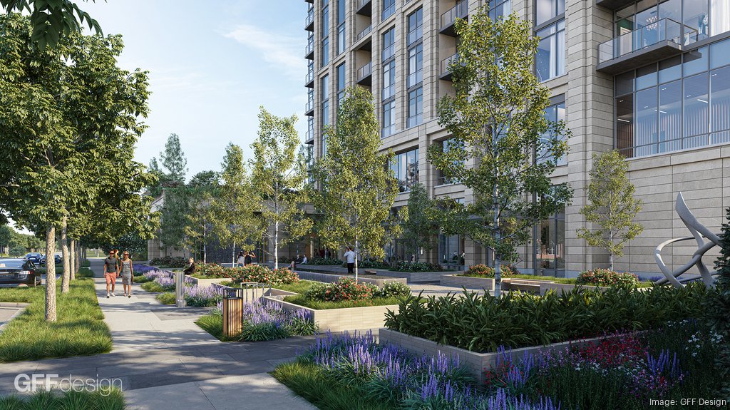
Dallas, TX—A new 28-story residential tower is being proposed at 4211 Newton Avenue in Dallas’ Oak Lawn neighborhood. Spearheaded by M&A Development, the 325-foot-high structure would total 404,000 square feet and replace the aging Chimney Six Condominiums—a 1960s-era two-story complex with 33 units. The developer is currently in the process of buying the site, which is awaiting rezoning approval due to a current 36-foot height restriction.
The Dallas developer plans to add density and premium housing to the area, aligning with city initiatives to promote vertical living. The building will provide one- and two-bedroom apartments, along with studio units, to attract more affluent residents, potentially including members of the nearby Equinox fitness club.
GFF is handling the architectural design, while Studio Outside is leading landscaping plans. The project site is located between Wycliff and Avondale Avenues, just a block off Oak Lawn Avenue, near Turtle Creek Village and The Shops of Highland Park.
Source: gff.com
Plans include a two-level underground parking garage, a large second-floor pool, and a 9,000-square-foot public pocket park with water features and sculptures. Roughly 40% of the site is planned as publicly accessible space, developers said. The park is designed to serve as a community asset, offering seating, water fountains, and shaded areas.
CEO Scott Theeringer of M&A Development argues that the tower’s height will transform parking lot views into skyline vistas, while Architect Evan Beattie of GFF supports the height variance, highlighting the livability and design benefits of a taller structure.
As part of the project, M&A plans to realign the curb eight feet inward on Newton Avenue to improve traffic flow and expand street parking. The development team is currently working through community outreach and zoning discussions, with hopes to break ground by late 2026 or early 2027. Construction is expected to take between 18 and 24 months.
The new high-rise is one of several developments transforming Oak Lawn. Around the corner, a strip mall is being redeveloped into a pedestrian-oriented, mixed-use destination by the Halperin family. These developments signal ongoing transformation in a nightlife area with a long-standing LGBTQ+ community.
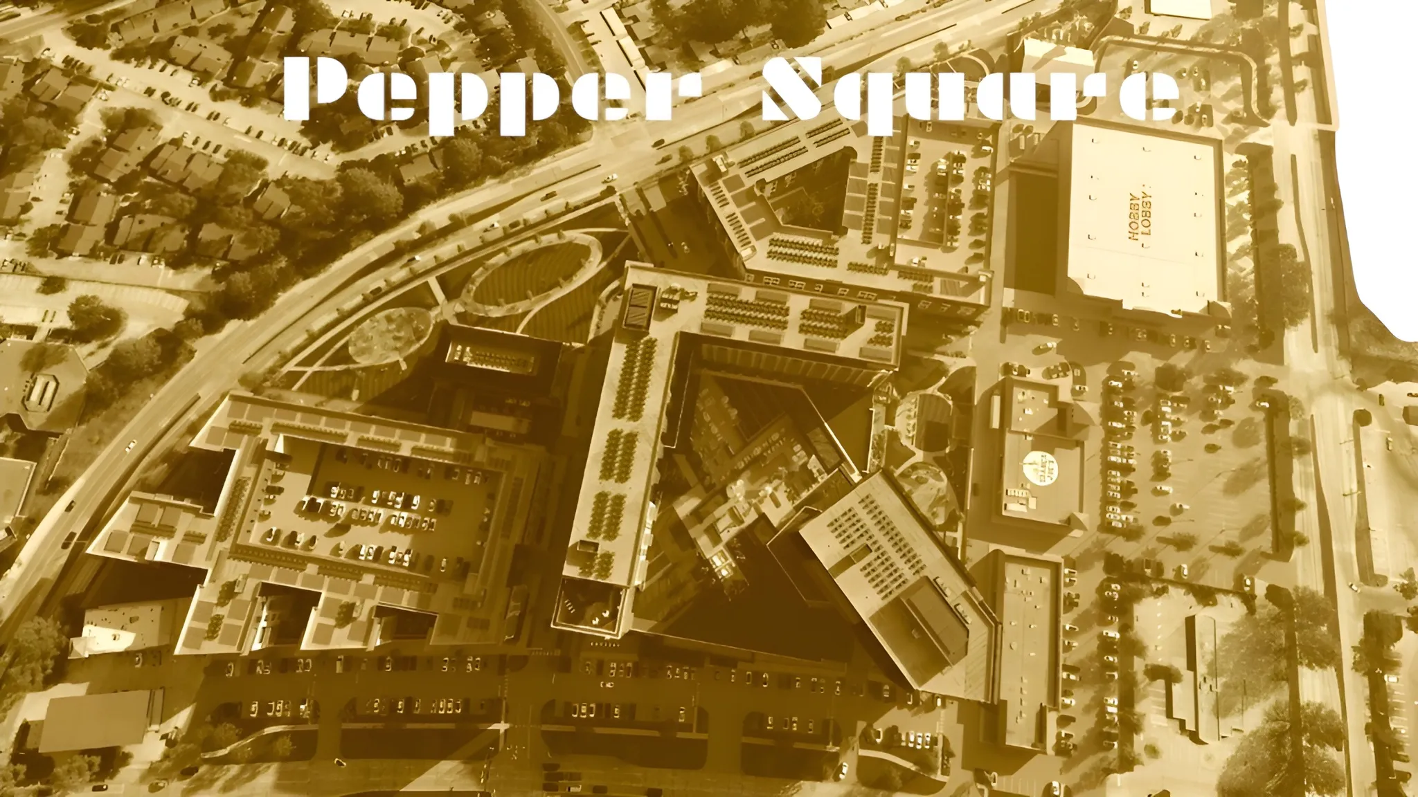
DALLAS — A high-stakes legal showdown is set for October as a North Dallas neighborhood association takes its fight against the $200 million Pepper Square redevelopment to a jury, marking a pivotal moment in a long-running dispute over the future of the 15.5-acre site at Preston and Belt Line Roads.
On Friday, Judge Martin Hoffman of the 68th District Court scheduled a jury trial for October 6, granting the Save Pepper Square Neighborhood Association its day in court to challenge the city’s approval of the controversial rezoning. At the heart of the lawsuit: allegations of “illegal spot zoning” and accusations that Dallas city officials are disregarding their own comprehensive land use plans.
“We’re very happy,” said Matt Bach, who leads the neighborhood association. “I think we’ve always had a strong argument, and the case had its merits, but you never know what the judge is going to think. Now, a jury of our peers will have the chance to weigh in.”
The legal wrangling has put the brakes on Henry S. Miller Co.’s ambitious plans to transform the aging strip center into a mixed-use hub featuring nearly 900 apartments and at least 35,000 square feet of retail. While supporters tout the project as a much-needed revitalization for a dated commercial corner, neighbors have repeatedly voiced concerns about density, traffic, and the erosion of their suburban character.
Despite the Dallas City Council’s vote in March to rezone the property, the neighborhood association swiftly mobilized—raising more than $75,000 to bankroll legal efforts and securing a temporary restraining order last month that halted any groundbreaking. The group contends that the rezoning constitutes “spot zoning,” a practice where a small parcel is singled out for a use inconsistent with the surrounding area, which is generally prohibited under Texas law.
“It’s about the fact that what Henry S. Miller is trying to build does not fit with the character of our neighborhood,” Bach explained. “We’re not against development, but this is about following the rules and respecting the community.”
Some community leaders, including former District 11 Councilman Lee Kleinman, have called for Pepper Square to be designated as a Planned Development District to ensure more robust community engagement and tailored zoning regulations.
Under a tentative agreement approved by Judge Hoffman, the developer has agreed not to begin construction until after the October trial, while the neighborhood association has pledged not to seek further injunctions in the interim. Both sides say the arrangement is reasonable, if only a temporary truce.
“We think there is a case for spot zoning, and the court allowing this trial is going to let us prove it—and let a jury hear it,” said Austin Smith, lead attorney for the association and a partner at Steckler Wayne & Love PLLC. “We’re preparing for trial and confident in our position.”
For now, the fate of Pepper Square hangs in the balance. As legal teams prepare for a fall courtroom battle, the case has become a flashpoint in Dallas’ ongoing debate over growth, zoning, and neighborhood preservation.
“We’re confident a jury will see this for what it is,” Bach said. “This is about more than just one project—it’s about the future of our community.”